Delineate Anything v2: A Global Foundation Model for Field Delineation
Mykola Lavreniuk1, 2,
Nataliia Kussul3,
Andrii Shelestov2, 4,
Yevhenii Salii2, 4,
Volodymyr Kuzin2, 4,
Charlotte Julia Li-Xing Wang1,
Zoltan Szantoi1
1 European Space Agency,
2 SRI NASU-SSAU,
3 University of Maryland,
4 Igor Sikorsky Kyiv Polytechnic Institute
ECCV 2026
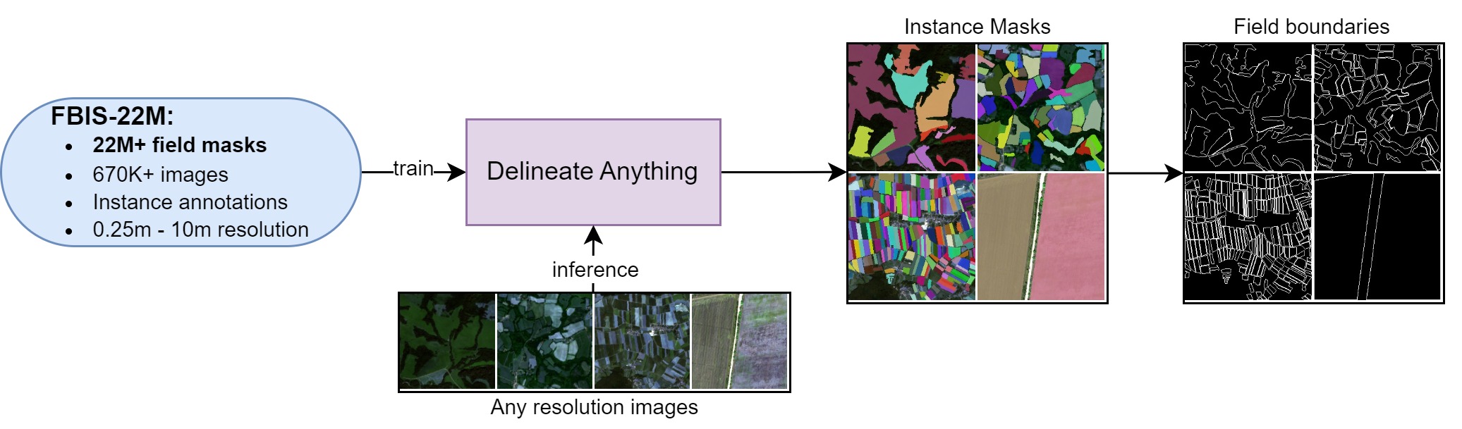
Figure 1a. Workflow of Delineate Anything. Field instance segmentation and field boundary extraction from arbitrary resolution satellite imagery, trained on the Field Boundary Instance Segmentation dataset (FBIS-22M), containing 22M field boundaries.
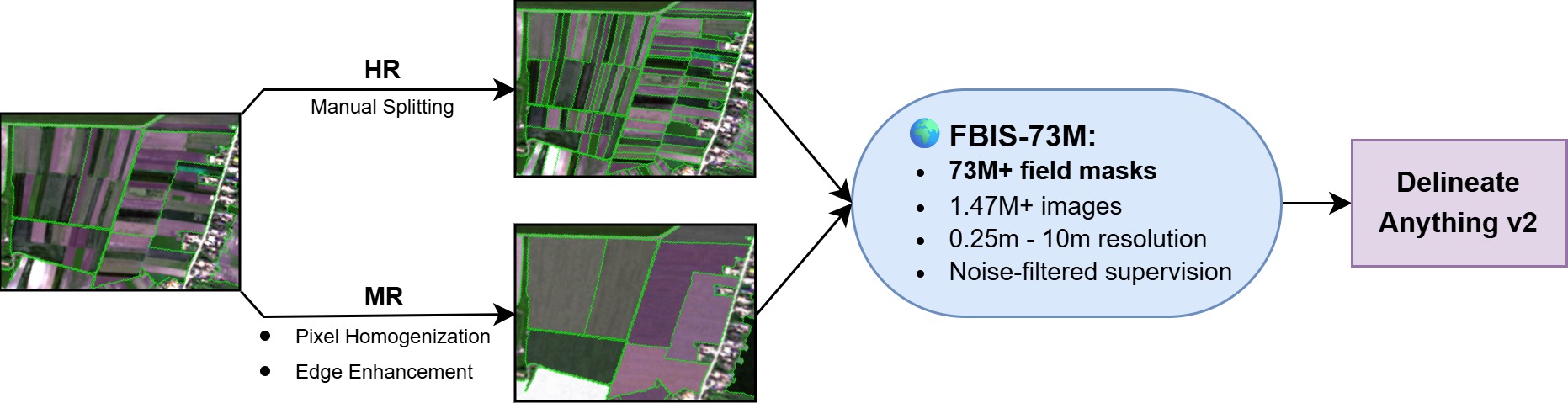
Figure 1b. Workflow of Delineate Anything v2. A resolution-specific data curation pipeline homogenizes merged administrative parcels and strengthens weak physical boundaries across 61 countries, producing FBIS-73M and a single globally-scalable, resolution-agnostic foundation model for field delineation.
Abstract
Accurate agricultural field boundary delineation at large scale is a foundational task for food security, supply chain transparency, and carbon accounting. While vision foundation models like SAM show remarkable zero-shot capabilities, they frequently fail in geospatial domains due to topological complexity, cropland texturing patterns, and a lack of physical scale awareness. In this work, we introduce Delineate Anything v2, a globally scalable foundation model designed specifically for wide-area field boundary mapping. We construct FBIS-73M, a 73-million-instance multi-resolution dataset spanning 61 countries. To address the pervasive issue of multi-field administrative parcel merging, we introduce a resolution-specific data curation pipeline that leverages topological image-space adaptation to homogenize merged parcels and strengthen weak physical boundaries. Furthermore, we establish a novel, manually curated evaluation benchmark covering 100 countries to assess independent zero-shot generalization. Our results show that Delineate Anything v2 surpasses the current state-of-the-art, including the Delineate Anything framework, by 0.284 mAP@0.5 (+103.3% relative gain), while maintaining execution speeds suitable for rapid national- and global-scale deployment, as demonstrated by nationwide mapping of Ukraine (603,000 km²) in 5.4 hours on a consumer-grade workstation.
Methodology
- A novel task formulation of field boundary detection as an instance segmentation problem, addressing the inherent limitations of semantic segmentation for this task.
- We construct FBIS-73M, a 73-million-instance multi-resolution field boundary repository spanning 61 countries — the largest public dataset of its kind.
- We propose a data-centric noise remediation strategy that resolves the parcel-merging anomaly by combining manual partitioning for HR data with automated image-space pixel homogenization for MR data.
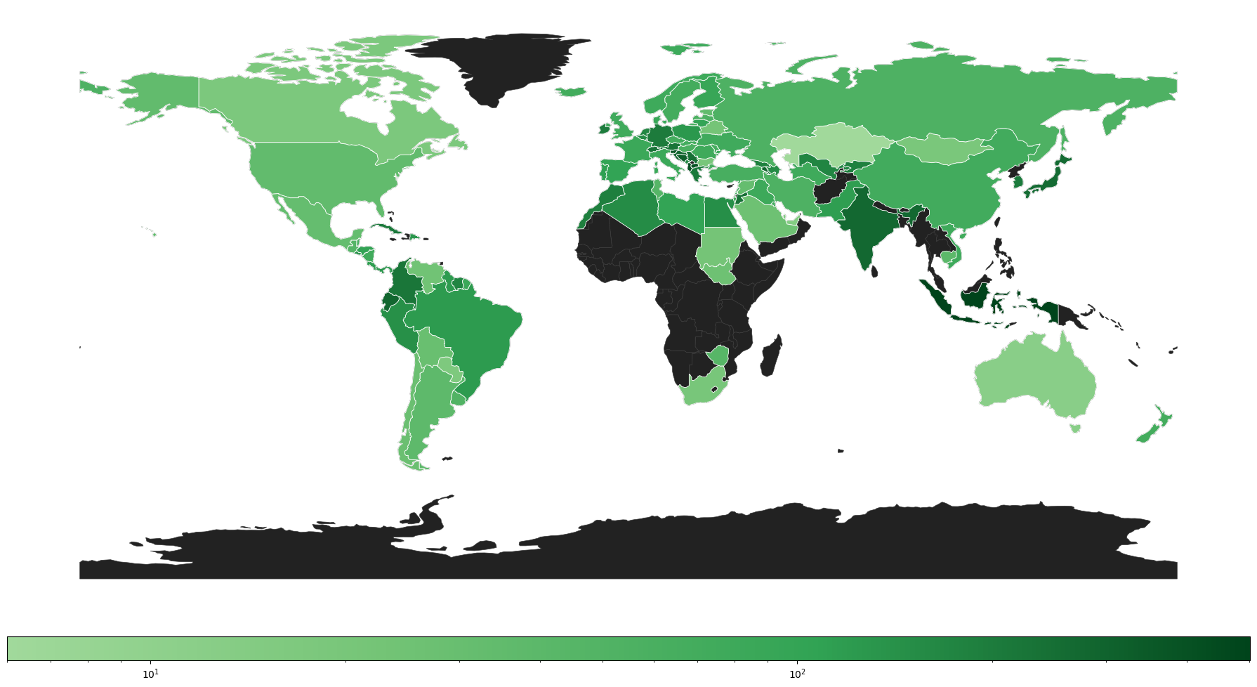
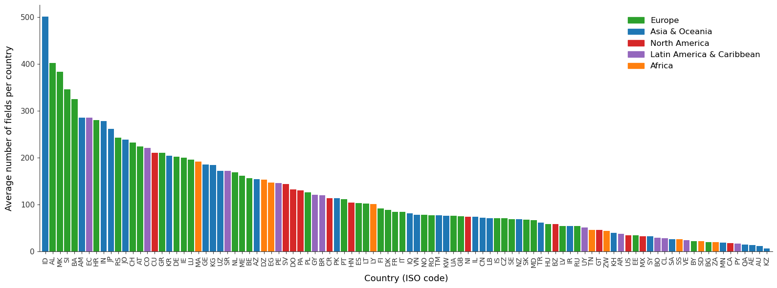
- We manually curate a high-fidelity validation benchmark spanning 100 countries to evaluate generalization across diverse agricultural regimes.
- We demonstrate that Delineate Anything v2 establishes a new state-of-the-art for global agricultural field delineation, surpassing the previous state-of-the-art Delineate Anything framework by 0.284 mAP@0.5 (+103.3% relative gain) and enabling nationwide mapping of Ukraine (603,000 km²) in 5.4 hours on a consumer-grade workstation.
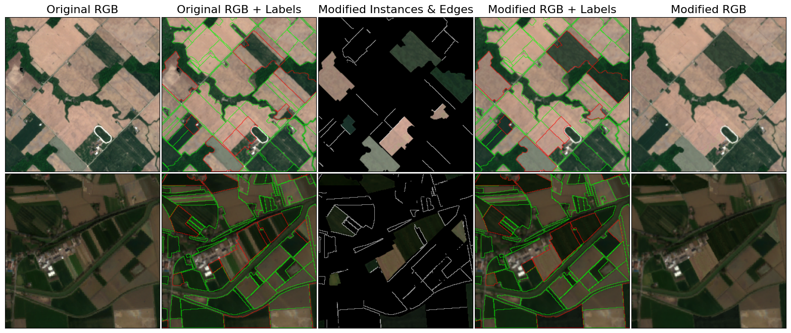
Figure 2. Automated medium-resolution topological image-space adaptation. Left to right: raw satellite patch; original administrative contours with parcel-versus-field mismatches highlighted in red; homogenized fields extracted via the anomaly mask; modified raster with unaltered (green) and remediated (red) contours; the finalized patch.
Field Boundary Instance Segmentation - 73M (FBIS-73M) dataset
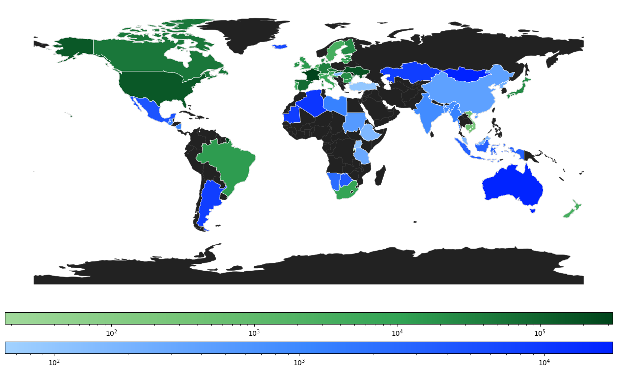
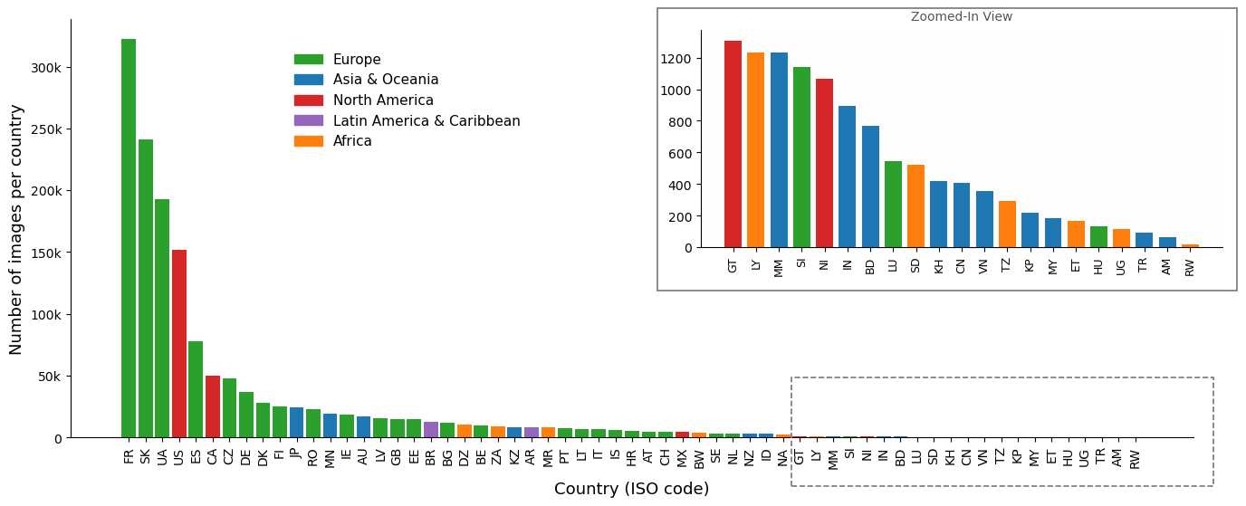
FBIS-73M extends FBIS-22M into a 73-million-instance, multi-resolution (0.25m–10m) dataset spanning 61 countries with diverse imagery sources, built through a resolution-specific curation pipeline that resolves the parcel-versus-field mismatch present in raw administrative boundary sources.
Figure 3. Geographic distribution of the training and evaluation data. (a) Sample density across the 61 countries in FBIS-73M, with per-country counts below. (b) Field density across the independent 100-country evaluation benchmark, with average fields per country below.
Table 1. Comparison of FBIS-73M with existing general computer vision and field boundary delineation datasets. FBIS-73M is the largest and most diverse dataset of its kind, spanning 61 countries at resolutions from 0.25m to 10m.
| Dataset | Resolution | # Images | # Instances |
|---|
| General Computer Vision Datasets |
| LAION-5B (Schuhmann et al., 2022) | - | 5.85B | - |
| COCO (Lin et al., 2014) | - | 330K | 1.5M |
| Open Images (Kuznetsova et al., 2020) | - | 998K | 2.8M |
| SA-1B (Kirillov et al., 2023) | - | 11M | 1.1B |
| Field Boundary Delineation Datasets |
| Farm Parcel (Aung et al., 2020) | 10m | 2K | - |
| India10K (Wang et al., 2022) | - | - | 10K |
| PASTIS (Garnot and Landrieu, 2021) | 10m | 2K | 124K |
| PASTIS-R (Garnot et al., 2022) | 10m | 2K | 124K |
| PASTIS-HD | 1m & 10m | 2K | 124K |
| AI4SmallFarms (Persello et al., 2023) | 10m | 62 | 439K |
| AI4Boundaries (d'Andrimont et al., 2023) | 1m & 10m | 55K | 2.5M |
| Fields of The World (Kerner et al., 2024) | 10m | 70K | 1.63M |
| FBIS-22M (Lavreniuk et al., 2025) | 0.25m-10m | 673K | 22.9M |
| FBIS-73M (Lavreniuk et al., 2026) | 0.25m-10m | 1.47M | 73M |
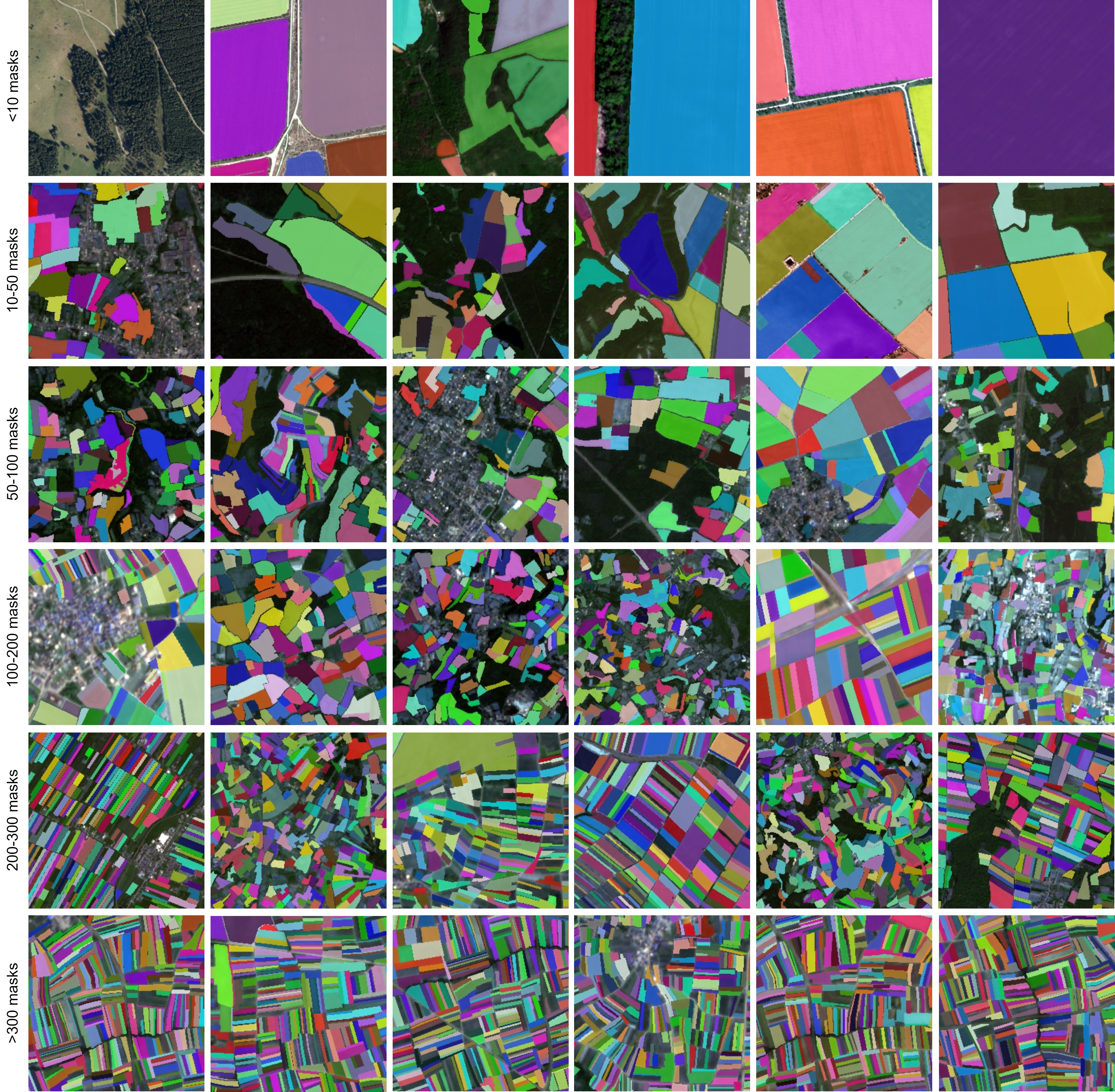
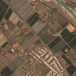
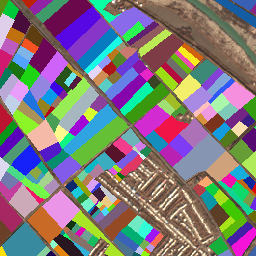
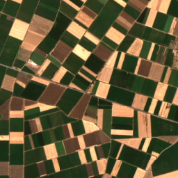
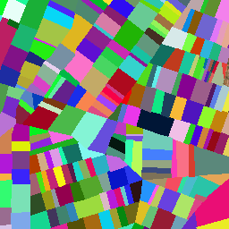
Figure 4. Examples of field boundary instance segmentation. Images span resolutions from 0.25m to 10m and are grouped by the number of fields to demonstrate the dataset's diversity and scalability.
Results
Table 2. Global Benchmark (100-Country Independent Evaluation).
| Method | mAP@0.5 | mAP@0.5:0.95 | Precision | Recall | Latency (ms) | Size |
|---|
| Delineate Anything | 0.275 | 0.103 | 0.345 | 0.454 | 25.0 | 125 MB |
| Delineate Anything v2 | 0.559 | 0.278 | 0.639 | 0.525 | 25.0 | 125 MB |
Table 3. Regional Performance Breakdown (mAP@0.5). Delineate Anything v2 improves everywhere, with the largest gains in regions where the original model struggled most (Africa, Asia & Oceania).
| Method | Europe | Africa | Asia & Oceania | Latin America | North America |
|---|
| Delineate Anything | 0.332 | 0.251 | 0.161 | 0.314 | 0.317 |
| Delineate Anything v2 | 0.612 | 0.584 | 0.440 | 0.563 | 0.618 |
Table 4. Ablation study of dataset scaling and data-centric remediation strategies.
| Training Configuration | mAP@0.5 | Gains (Δ) |
|---|
| FBIS-22M (Baseline) | 0.275 | – |
| FBIS-73M (Raw labels, No Curation) | 0.361 | +0.086 |
| FBIS-73M (+ HR Manual Split) | 0.409 | +0.048 |
| Delineate Anything v2 (Full Curation Pipeline) | 0.559 | +0.150 |
Note: For a quantitative and qualitative comparison of Delineate Anything against generic vision foundation models (SAM, SAM2) and MultiTLF, see Table 2 and Figure 4 in the Delineate Anything paper.
Qualitative Visualization
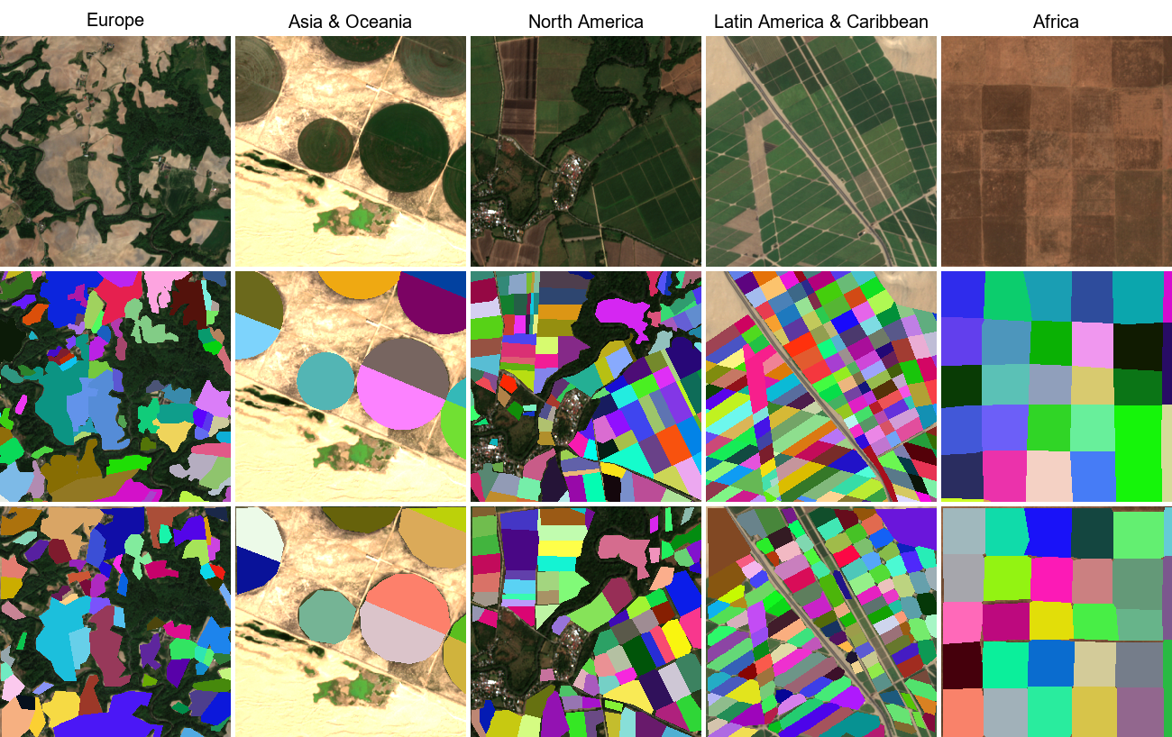
Figure 5. Zero-shot qualitative results across major macro-regions. Rows (top to bottom): raw RGB imagery, manual ground truth, and Delineate Anything v2 predictions. Columns represent Europe (Norway), Asia & Oceania (United Arab Emirates), North America (Costa Rica), Latin America & Caribbean (Peru), and Africa (South Sudan).
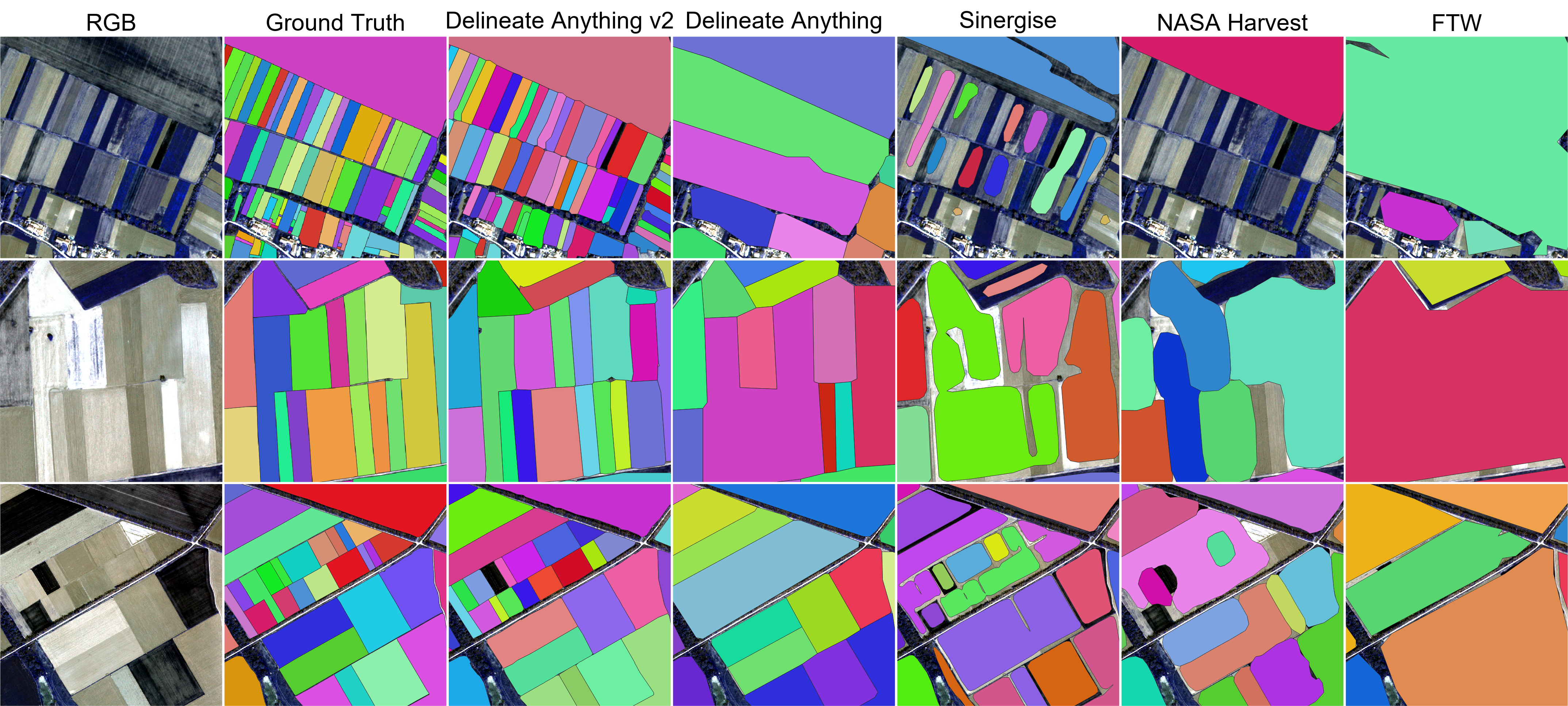
Figure 6. Qualitative comparison against operational mapping products. The field boundaries extracted by Delineate Anything v2 and the manual ground truth are contrasted directly with publicly available static layers from Delineate Anything, NASA Harvest, Sinergise Solutions, and Fields of the World (FTW).
BibTeX
@inproceedings{lavreniuk2026delanyv2,
  title={Delineate Anything v2: A Global Foundation Model for Field Delineation},
  author={Mykola Lavreniuk and Nataliia Kussul and Andrii Shelestov and Yevhenii Salii and Volodymyr Kuzin and Charlotte Julia Li-Xing Wang and Zoltan Szantoi},
  year={2026},
  booktitle={European Conference on Computer Vision Workshops (ECCVW)},
}

@inproceedings{lavreniuk2025delineateanything,
  title={Delineate Anything: Resolution-Agnostic Field Boundary Delineation on Satellite Imagery},
  author={Mykola Lavreniuk and Nataliia Kussul and Andrii Shelestov and Bohdan Yailymov and Yevhenii Salii and Volodymyr Kuzin and Zoltan Szantoi},
  year={2025},
  booktitle={European Conference on Artificial Intelligence},
}

@article{lavreniuk2025delineateanythingflow,
  title={Delineate Anything Flow: Fast, Country-Level Field Boundary Detection from Any Source},
  author={Mykola Lavreniuk and Nataliia Kussul and Andrii Shelestov and Yevhenii Salii and Volodymyr Kuzin and Sergii Skakun and Zoltan Szantoi},
  year={2025},
  journal={https://arxiv.org/abs/2511.13417},
}